Great Outdoors Orange County/Long Beach Chapter presents
OCLB - Sunset Hike to Mount Hollywood Summit
Distance 6 miles | Elevation gain 1130 ft
June 25, 2022, 6:00 PM
(Registration is open from June 1 through June 25, 2022)
Contact: Robert Sandoval, email: [email protected]
Join us on Saturday, June 25th at 6:00 pm for a sunset hike in the historic Griffith Park Destination, Mt Hollywood Summit! With over 4,210 acres of terrain, Griffith Park is one of the largest municipal park wilderness areas in the U.S. Situated at the east end of the Santa Monica Mountain range, the Park has an elevation range from 384 to 1,625 feet above sea level. And this hike is going to cover the entire gamut!
There are many trails that lead to Mt Hollywood Summit, on this summer night we will be taking it from the east side of the park that is bordered by the 5 freeway. FYI, the summit is also known as the Tom LaBonge Summit. On some maps, this peak is also known as Griffith Observatory Trail Peak.
As pointed out on their website, Griffith Park has a 53-mile network of trails, fire roads, and bridle paths. We will be covering just 6 miles of them. We will NOT power-walk these trails, but instead, take it leisurely with three planned 5-minute breaks before reaching the top where we will have our evening meal break.
We should reach Mt. Hollywood Summit by 7:15 pm. The sun sets at 8:38 pm.
My friends and I usually start this hike at 7 pm and finish around 9:30 pm. We have never found the need for headlamps. The moonlight is bright enough to keep the fire roads visible, even on overcast nights. But do not let me dissuade you from doing what makes you feel safe and what's necessary to watch your steps.
The hike that I have planned is a variation of a loop I do with friends every week. I would rate this as a Moderate+ hike for a few reasons.
-
It has a 1,129-foot elevation gain. Only a few sections are steep fire roads that will fully exercise your lungs.
-
There is not much shade from trees; the hills are mostly natural chaparral-covered terrain.
-
Although much of what we will hike is fire roads, we will get off them for shorter more scenic paths. It is on these paths where there are a few situations that may require 3 points of contact for balance.
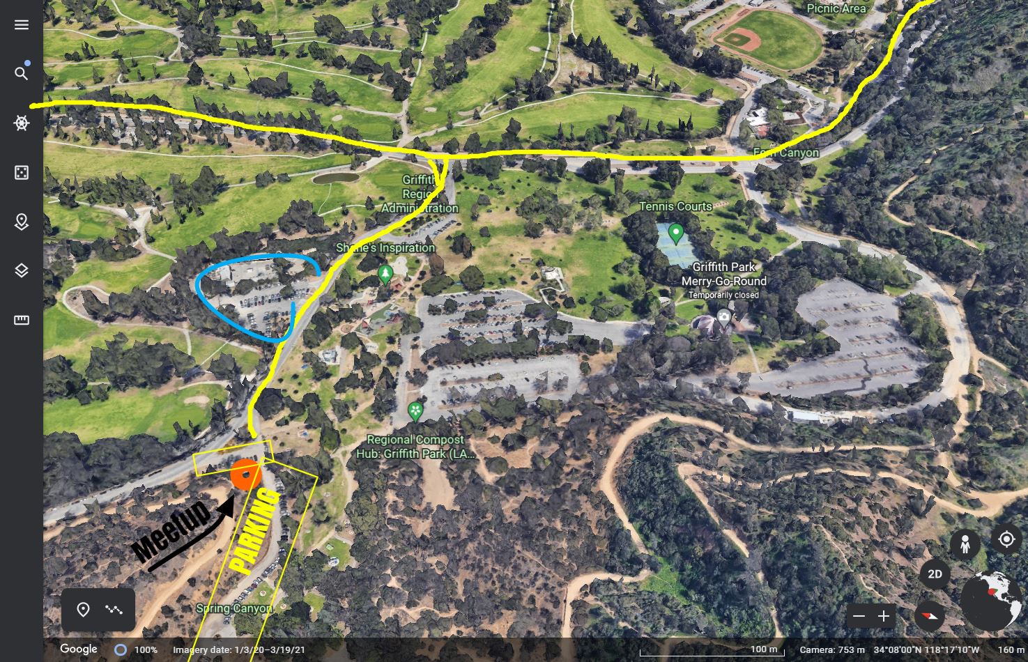
Where to meet: Clicking this link should open a Map to give you directions to this parking area. There is one long and one short strand of parking lanes here. I have avoided choosing a parking lot to meet because there are a few of them and it never fails that someone is in the wrong lot. So look for the roadside parking area and not any parking lots.
In the event the roadside parking is full, outlined in blue is a nearby lot. Here are a couple of visuals: Google Earth and Google Maps.
So, let's get started! From the get-go, we will avoid the first of the fire roads (Mineral Wells Trail) and take a couple of smaller and shorter well-traveled trails. The start of the first trail has a 12-foot steep incline grade that will require three points of contact to get a strong foothold onto its path.

We will take the trail and ascend 250 feet where we will meet up with another fire road (Bill Eckert Trail) and where you will immediately get a great vista of the Glendale city skyline. We will stop here for our first 5-minute resting break.
Again, we will avoid staying on the fire road and immediately jump onto the next leg of this path. The start of this trail also has a 12-foot steep grade that will require three points of contact to get a strong foothold onto its path.
This stretch of the hike has a 378-foot elevation gain, where our small trail re-joins the Bill Eckert Trail which eventually meets up with an old abandoned paved road Vista del Valle Dr., This road will take us to our next resting point that has a water fountain and some shade. Here we will take a 5-minute break.
Then, off we go to the next leg of our hike. It is the smallest elevation gain (238 feet) before our next break. But don't let smaller gains fool you; this portion of our hike has the steepest grade -- we call it 'Cardiac Hill'. To start, we continue on Vista del Valle Dr. for the length of a football field before we hop onto the North Trail heading south. At the end of Cardiac Hill, there is a point for us to rest for another 5-minute break (maybe longer).
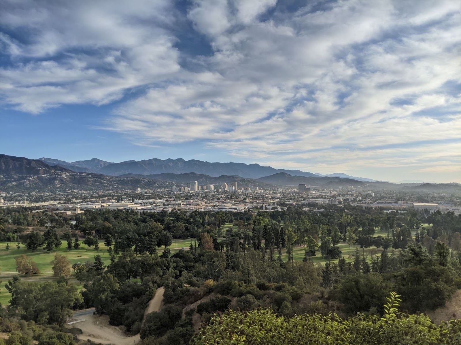
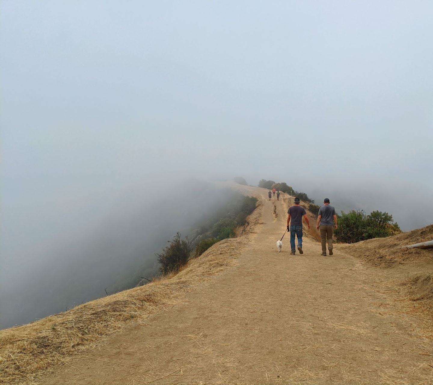
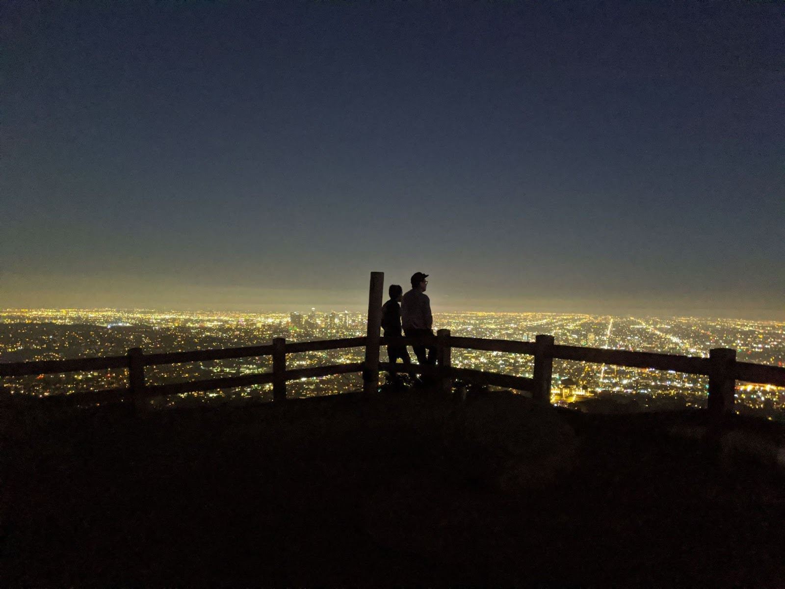
Now that we've caught our breath, let's finish our ascent to get to our destination! There are no more planned rest stops to Mt Hollywood Summit. We will continue south on North Trail to ascend another 269 feet. Halfway through this stretch, you will be traversing a saddle ridge with 360-degree vistas that include downtown Glendale, Burbank, parts of Hollywood, and Mount Washington. I seemed to only find one image when we were in a fog bank.
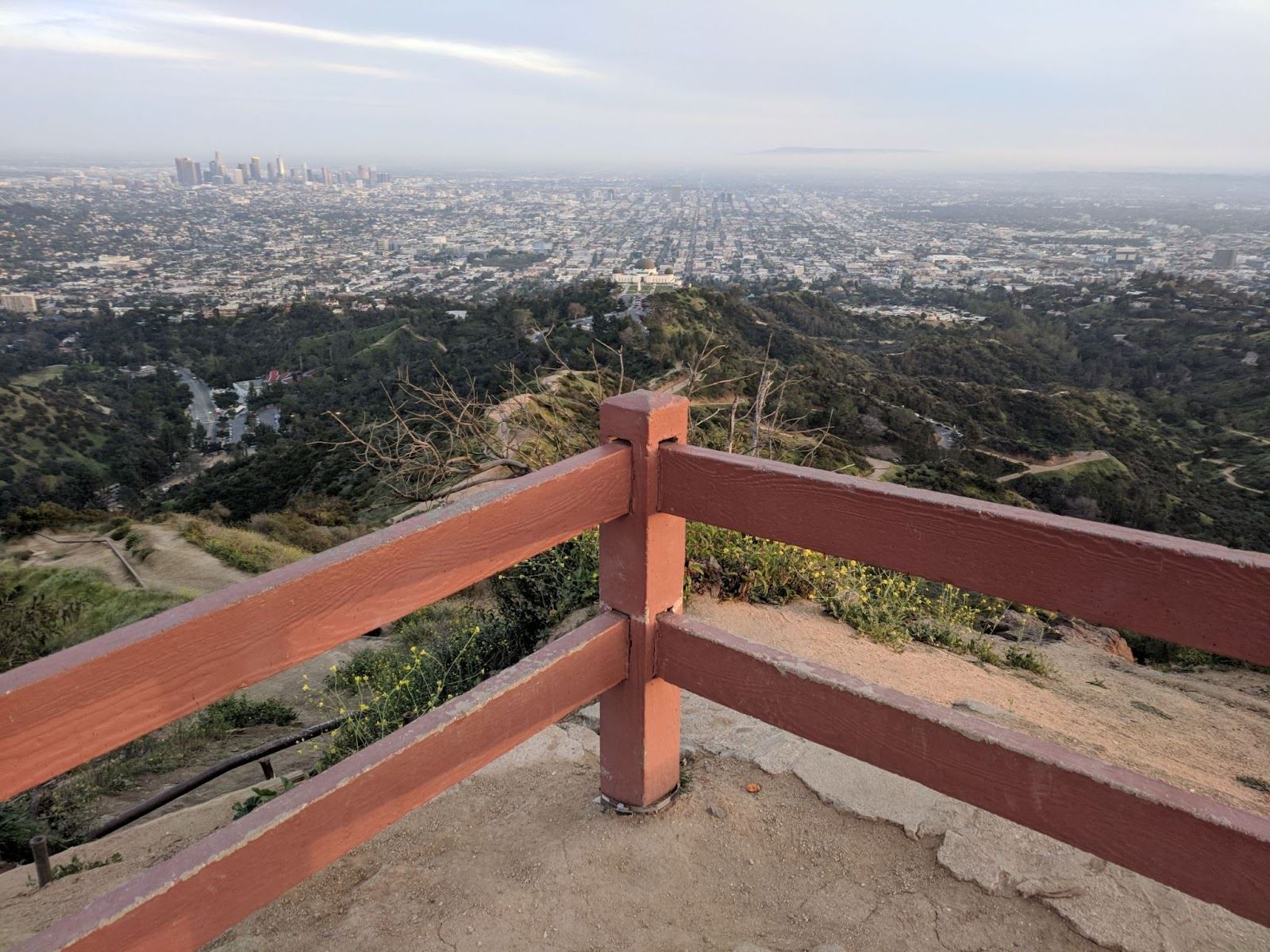
Once we reach Mount Hollywood Summit we will have views of the entire L.A. Basin and Catalina on a clear day. There are 4 cement park benches available, and it is here where we will enjoy our packed meals.
When ready, we will head back down to complete our loop. We will start off on Hogback Trail heading east. This will take us to the southern point of Vista del Valle Dr.
It is where these two roads meet that serves as a popular destination with impressive views of the downtown L.A. skyline and The Griffith Observatory to your right.. It is popular for its flattened paved area that serves as an emergency helipad. This is where bicyclists, runners, and hikers convene. I once witnessed a yoga class in session too.
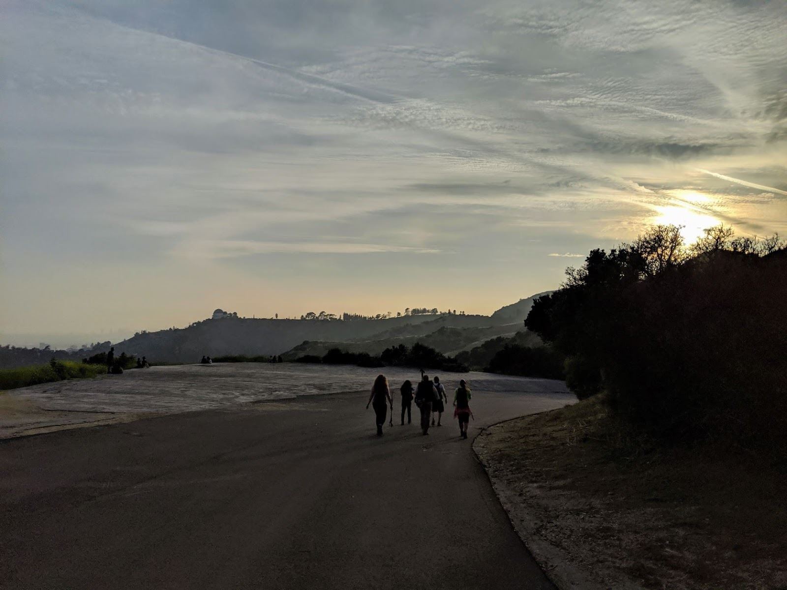
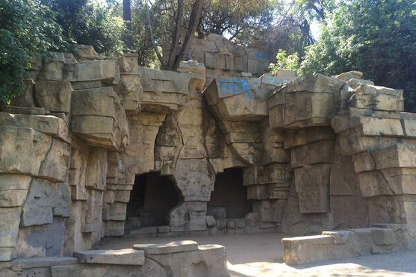
After a 5 minute break for selfies, we will continue our way down on Vista del Valle Dr. and hop off it to join Upper Beacon Trail. We will descend to 5 Points, which is what the name implies, a point where 5 trails meet. We will turn left onto a lower path called Fern Canyon Trail that will take us most of the way down until we meet up with Lower Old Zoo Trail. This fire road leads us to our last destination and historical point of interest -- the original, now abandoned Old L.A. Zoo.
We will approach the backside of the abandoned animal enclosures first. Most of it is covered with graffiti even though there have been attempts to chain-link and keep people out. When we round the themed rock-work enclosures, the front side of these abandoned wild-animal habitats you will find them better maintained and re-painted as they get tagged.
After exiting the Old L.A. Zoo, we are only a few football fields away from where we parked and will reconvene. I expect we will end our sunset hike a little past 9 pm and I assume most will want to hit the road and start their drive home.
If you have any questions about this hike, please do not hesitate to reach out to me, your trip leader, Robert Sandoval at [email protected]. Robert's co-lead will be Lance Whitmier.
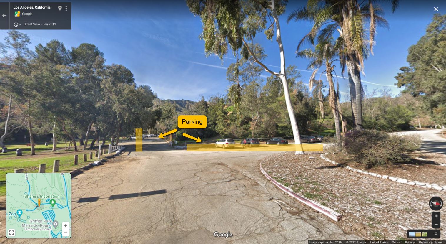
There is plenty of parking at our meetup designation: CLICK HERE FOR A STREET VIEW MAP OF THE PARKING AREA
A WhatsApp group has been created called: OCLB Mt Hollywood Summit. Please feel free to join after you have RSVP'd for this hike. If there are any last-minute day-of cancellations, please let us know through the group app. If you do not have a Whats App account and prefer to communicate via text, please email me with your phone number--if you prefer.
We look forward to seeing many old familiar faces and some new.
Here is an ALL TRAILS map of the 'OCLB - Mount Hollywood Summit Day Hike'. (Note Lake Hollywood to the West. My next planned hike will be from the Lake Hollywood dam to the Hollywood Sign, which is near Cahuenga Peak.)
Summary:
-
Elevation Start (495 ft) Parking lot
-
Rest Stop #1 (738 ft) 3 min. break
-
Rest Stop #2 (1116 ft) 3 min. break (water fountain available)
-
Rest Stop #3 (1355 ft) 3 min break
-
Destination Stop #4 (1624 ft) 20 min break
-
Rest Stop #5 (1060 ft) Helipad Photo Op 3 min break
-
Abandoned Old L.A. Zoo (587 ft)
-
Back to Start 495 ft parking lot
Robert Sandoval